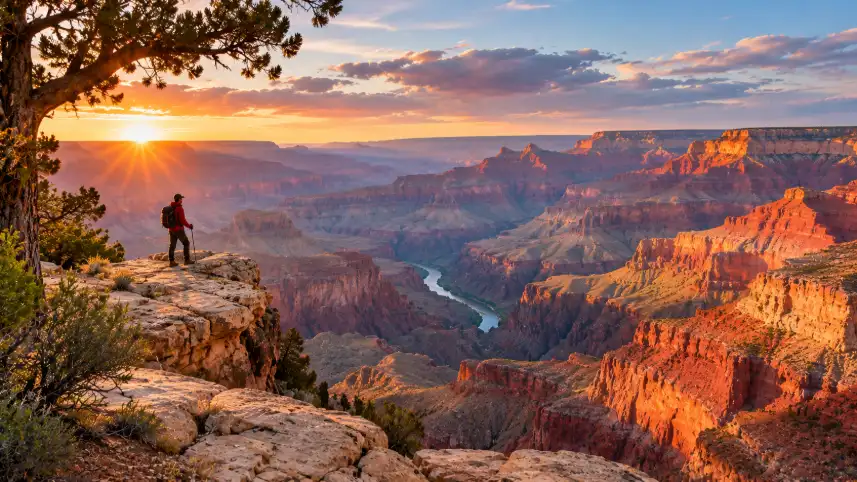
15 Best Things to Do in Grand Canyon National Park range from sunrise viewpoints and rim walks to demanding canyon descents, Colorado River rafting and quiet forest stays. The best choice depends on your season, fitness, preferred rim and comfort with heat, snow and elevation changes.
Grand Canyon National Park suits many travel styles because the South Rim and North Rim offer very different experiences. Visitors can enjoy drive-up overlooks, high-elevation forests on the Kaibab Plateau, fine dining, backcountry hiking and rafting trips that cover up to 280 miles (451 km) along the Colorado River.
- Late September to early October offers comfortable hiking temperatures and North Rim fall color.
- Mid to late May and mid-September to mid-October are strong periods for Rim-to-Rim hiking.
- North Rim access is seasonal, while the canyon floor can feel much hotter than the rim.
- Check current road, trail, weather and lodging conditions before traveling.
Grand Canyon is a place of extremes. Snow can cover upper trails in winter, while summer heat becomes dangerous below the rim. A short-looking descent can become a difficult uphill climb because the return journey gains elevation in warmer conditions.
When is the best time to visit?
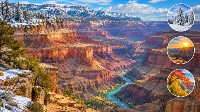
The best time to visit Grand Canyon National Park depends on what you want to do. Late September to early October is especially attractive for visitors who want cooler hiking conditions across different elevations, fall colors on the North Rim and access shortly before the seasonal closure.
Rim-to-Rim hikers should consider mid to late May in spring or mid-September to mid-October in fall. These periods can provide more manageable temperatures than the hottest part of summer, although trail and weather conditions can still change quickly.
The National Park Service warns that temperatures at Phantom Ranch can feel similar to Phoenix. Therefore, comfortable weather at the rim does not mean conditions below the rim are equally safe. Snow, heat, storms and elevation can affect roads, trails and river access.
The North Rim is not open year-round. Its higher elevation holds snow longer than the South Rim, so travelers should confirm opening and closing conditions before planning a trip around North Kaibab Trailhead or North Rim lodging.
South Rim or North Rim?
The South Rim offers more familiar access to Grand Canyon Village, the Rim Trail, major viewpoints and several lodging options. The North Rim is higher, cooler and quieter, with an average elevation of about 8,000 feet (2,438 meters), compared with roughly 7,000 feet (2,134 meters) or lower on much of the South Rim.
Only about 10% of Grand Canyon visitors reach the North Rim, according to the information provided by the National Park Service. That lower visitation can mean more solitude, but it also means fewer nearby services and less immediate help on remote trails.
Late September to early October can bring colorful aspen foliage to the North Rim. Wildlife sightings may include bison, black bears, elk and mule deer, while elk are common around the South Rim. Visitors should keep a safe distance from every wild animal.
What are the 15 best things to do?
The following activities are not ranked from best to worst. Together, they cover sunrise, sunset, easy walks, strenuous trails, scenic lodging, rail travel, guided trips and river adventures.
1. Ooh Aah Point
Ooh Aah Point sits about 0.9 miles (1.4 km) down the South Kaibab Trail. The listed distance is 1.8 miles (2.9 km), with about 790 feet (241 meters) of elevation change. Its broad view makes the short outing one of the most rewarding sunrise hikes on the South Rim.
Sunrise is the strongest time to visit because the South Kaibab Trail can become busy by midday. Remember that the return route climbs uphill, so carry water and leave enough time for the ascent.
2. The Rim Trail
The South Rim’s Rim Trail extends 12.7 miles (20.4 km) one way and links many viewpoints near Grand Canyon Village and beyond. Visitors do not need to complete the entire route. A short section can still provide wide canyon views without the commitment of a below-rim hike.
The Grand Canyon Shuttle allows hikers to return from several stops. That makes the Rim Trail useful for families, photographers and travelers who want to control the distance according to weather, daylight and energy.
3. Hopi Point and Mohave Point
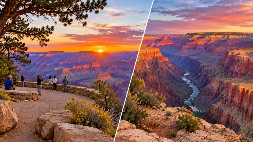
Hopi Point and Mohave Point are two of the best sunset locations along Hermit Road. Mohave Point stands out for its view of the Colorado River. Hopi Point offers a wider panorama, including changing colors across the canyon away from the setting sun.
Hopi Point is usually busier because it is widely promoted as a prime sunset stop. Mohave Point may suit visitors who prefer a slightly quieter setting and want the river included in their photographs. Shuttle schedules and current access should be checked before departure.
4. Rim-to-Rim hiking
Rim-to-Rim hiking is a demanding backcountry journey across the Grand Canyon. The distance is about 21 miles (33.8 km) from South Kaibab Trail to the North Rim, or 23.5 miles (37.8 km) from Bright Angel Trail to the North Rim.
The challenge is not only distance. Hikers must manage heat, elevation change, water, weather and overnight logistics. Camping permits inside the canyon are highly competitive, so travelers should study current permit rules through the official Grand Canyon National Park website before committing to a route.
Those who cannot secure an overnight permit should not treat the trail as a casual day hike. A return trip from the river to the rim adds a major uphill effort in conditions that may be much hotter below the rim.
5. Shoshone Point
Shoshone Point is a quieter South Rim viewpoint because vehicles cannot drive directly to the overlook. Visitors reach it by hiking from one of two directions, creating a more secluded alternative to the park’s busiest roadside viewpoints.
The distance can range from 2.1 to 5.2 miles (3.4 to 8.4 km), depending on the approach. This option suits travelers who want a short outing with less traffic, although the route and current access should be confirmed before setting out.
6. Grandview Point
Grandview Point is an east-facing, drive-up viewpoint that works well for sunrise. Unlike Yaki Point, it allows visitors to park nearby, making it a practical choice for travelers who want a broad view without a long approach hike.
The view toward Navajo Point shows how the Kaibab Plateau drops toward Cameron and the Painted Desert. Its higher elevation also helps explain why this area can feel cooler while offering expansive canyon depth and opportunities to see wildlife.
7. Stay inside the park
Staying inside Grand Canyon National Park makes it easier to see sunrise, sunset and early trail conditions without a long drive from an outside town. North Rim and South Rim lodging options include the Grand Canyon Lodge, El Tovar Hotel, Kachina Lodge, Thunderbird Lodge, Bright Angel Lodge, Maswik Lodge and Yavapai Lodge.
The Grand Canyon Lodge was lost in the Dragon Bravo Fire, and rebuilding plans are in process. Travelers should verify current lodging availability rather than relying on older booking information. Reservations often fill six to twelve months ahead, especially during popular travel periods.
Visitors who cannot find suitable lodging inside the park can compare options in Tusayan or Williams. Williams is about an hour south of Grand Canyon Village and may offer a lower-cost base, although drive time and fuel should be included in the plan.
8. Explore the North Rim
The North Rim provides a cooler and quieter Grand Canyon experience. Its higher elevation supports aspen trees, which can produce striking fall color around the last week of September and the first week of October when conditions align.
The North Rim also offers more day-hiking destinations across the North Kaibab Plateau than the South Rim. That makes it appealing for visitors who want to spend several days outdoors without focusing entirely on long descents below the rim.
Remote conditions require extra preparation. Bison, black bears, elk and mule deer may be present, and assistance can be less available than around Grand Canyon Village. Check seasonal road access before driving to the North Rim.
9. Ride the Grand Canyon Railway
The Grand Canyon Railway travels 65 miles (105 km) from Williams, Arizona, to Grand Canyon Village on the South Rim. The route climbs through northern Arizona and the Ponderosa forests of the South Kaibab Plateau.
A train journey can reduce driving during a South Rim visit and add a different perspective on the landscape. It may also suit travelers who prefer a structured sightseeing experience rather than planning every stop independently.
10. Havasupai Trail
The Havasupai Trail is a demanding backcountry option with a listed one-way distance of 16.7 miles (26.9 km) to the confluence and approximately 3,300 feet (1,006 meters) of elevation change. Although parts of the route extend outside Grand Canyon National Park, the wider experience is closely connected to the canyon region.
Permits are difficult to secure, much like permits for Rim-to-Rim trips. Travelers should compare current permit requirements, route conditions and access rules before choosing between these two major backcountry objectives.
11. Whitewater rafting
Colorado River rafting can range from a day trip to a multi-week expedition. Longer trips may cover about 280 miles (451 km) from Lees Ferry near Page to Diamond Creek or Pearce Ferry before Lake Mead.
Day trips commonly depart from Page, Flagstaff or Las Vegas. Longer journeys can reach locations such as the Confluence, which connects with the Havasupai area. Rafting requires careful planning because river conditions, trip length, equipment and operator requirements vary.
12. Dripping Springs Trail
Dripping Springs is a 6.4-mile (10.3 km) day hike below the rim near Hermit’s Rest. The trail reaches a natural spring while avoiding the greater distance and remoteness associated with the Hermit Trail and Boucher Trail.
This route can suit hikers seeking a quieter below-rim experience. It still involves elevation change and desert conditions, however, so a peaceful setting should not be mistaken for an easy trail.
13. Yaki Point
Yaki Point is a strong sunrise location because visitors can see morning light to the east and changing colors across the canyon to the west. It can pair well with an early outing on the Rim Trail, South Kaibab Trail or Shoshone Point Trail.
Parking is not allowed along Yaki Point Road or at the South Kaibab Trailhead. The closest vehicle parking is at Pipe Creek Vista on Desert View Drive, followed by the Rim Trail or available park transportation.
14. Take a private tour
A private Grand Canyon tour can simplify transportation, route selection and seasonal planning. Local guides operate from Flagstaff, Sedona and Las Vegas, giving visitors options when they prefer not to manage every logistical detail themselves.
Guided tours may also help travelers who do not want to descend below the rim or drive long distances. Compare cancellation terms, pickup locations, physical requirements and the exact areas included before booking.
15. Choose a custom canyon day
A flexible day can combine one sunrise viewpoint, a manageable section of the Rim Trail, a scenic meal and a sunset stop. This approach works well for beginners who want variety without attempting several strenuous activities in one day.
For example, a traveler could visit Yaki Point at sunrise, walk part of the Rim Trail, rest during the warmest hours and choose Mohave Point for sunset. The plan remains adaptable if heat, snow, thunderstorms or shuttle changes affect the schedule.
What should you pack for Grand Canyon hikes?
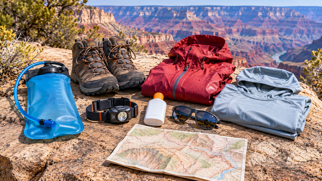
Grand Canyon hiking gear should support hydration, sun protection, changing weather and safe movement on uneven terrain. A three-liter water reservoir, headlamp, trail-appropriate shoes, a packable waterproof shell and a hooded sun shirt are useful starting points for many day hikes.
- Water reservoir: A three-liter bladder helps organize hydration during long or exposed outings.
- Headlamp: A reliable headlamp matters when sunrise hikes begin before daylight or a return takes longer than expected.
- Trail shoes: Choose footwear according to the surface and distance. A shoe suited to a smooth rim walk may not provide the same support on a steep descent.
- Rain shell: A packable waterproof layer can help during changing weather, particularly in higher elevations.
- Hooded sun shirt: Long-sleeved sun protection can reduce direct exposure during multi-day visits.
- Sunglasses and sunscreen: Bright desert conditions can affect comfort in every season.
Camping requires broader backpacking equipment, food planning and permit coordination. Gear should match the route rather than the destination name alone. A short rim walk and an overnight descent to the Colorado River place very different demands on the body and equipment.
Visitors buying outdoor equipment or an America the Beautiful Pass before travel may save time at arrival. Pass availability, pricing and current access rules should be checked with the relevant official or authorized seller.
How can you plan a safer visit?
Safety at Grand Canyon National Park begins with treating the rim and river as different climates. The information provided for the park notes an average temperature difference of about 17°F (9.4°C) between the South Rim and Colorado River, and as much as 26°F (14.4°C) between the North Rim and the river.
The descent often feels easier than the climb back out. That creates a common planning mistake: visitors judge their ability by the first half of the hike and underestimate the uphill return in hotter conditions.
- Check official trail, road, shuttle and weather conditions before leaving.
- Choose a route that matches your fitness, daylight and experience.
- Carry enough water and protect yourself from direct sun.
- Start demanding hikes early when conditions are cooler.
- Allow extra time for the return climb.
- Do not approach wildlife or leave food accessible.
- Watch for lightning during summer monsoon storms.
Potential hazards include steep drops, black ice, extreme heat, wildlife and lightning. The park is home to black bears, elk, bison, mountain lions, six rattlesnake species and the Gila monster. Stay on appropriate routes, keep distance from animals and follow posted warnings.
Conditions can change without much notice. Verify current guidance through the National Park Service Grand Canyon pages before departure, especially when visiting the North Rim or planning a below-rim hike.
Which nearby places fit a longer trip?
Grand Canyon National Park works well as part of a northern Arizona and southern Utah road trip. Page, Williams, Sedona and Kanab offer different combinations of short hikes, scenic drives, restaurants and nearby public lands.
| Nearby place | Best fit | Useful detail |
|---|---|---|
| Page, Arizona | Slot canyons and river views | Antelope Canyon, Horseshoe Bend, Big Lake Sand Cave and Cathedral Wash |
| Williams, Arizona | Route 66 atmosphere | Historic downtown, cafés, restaurants and access to the Grand Canyon Railway |
| Sedona, Arizona | Red rock hiking | About 2 hours and 15 minutes from Grand Canyon Village by the provided route estimate |
| Kanab, Utah | Short desert adventures | Moqui Sand Caves and access toward the Zion–Mount Carmel area |
| Southern Utah | National park road trip | Bryce Canyon, Zion, Arches and Canyonlands can extend the journey |
Page and the Colorado River
Antelope Canyon and Horseshoe Bend are natural companions to a Grand Canyon trip. Horseshoe Bend has a listed round-trip distance of 1.5 miles (2.4 km), while Cathedral Wash covers about 3.4 miles (5.5 km) and reaches the Colorado River with sections of Class 3 scrambling.
Big Lake Sand Cave is a short 0.2-mile (0.3 km) outing near Page. These options vary widely in difficulty, so a short distance does not automatically mean a route is suitable in hot weather or for every traveler.
Williams, Sedona and Utah
Williams offers Historic Route 66 restaurants, cafés and boutiques. Frontier Barbeque & Beer Garden, Anna’s Canyon Café and Goldies Route 66 Diner are examples of the dining options named for downtown Williams.
Sedona adds red rock scenery and hiking in the Red Rock Ranger District of Coconino National Forest. In southern Utah, Moqui Sand Caves provide a short 1.2-mile (1.9 km) trail near Kanab, while Bryce Canyon, Zion, Arches and Canyonlands can form a larger multi-park route.
Petrified Forest National Park and the Painted Desert offer a different landscape east of Grand Canyon. A 102-mile (164 km) section of historic Route 66 between Kingman and Ash Fork can also be added to a Las Vegas approach, with the provided route estimate describing about 16 extra miles (25.7 km) compared with the direct interstate drive.
What questions do first-time visitors ask?
Is the South Rim or North Rim better?
The South Rim offers broader access and more established visitor services. The North Rim is higher, cooler and quieter, with seasonal access and fewer visitors, so the better choice depends on your preferred scenery, lodging and tolerance for remote conditions.
Can beginners hike from rim to rim?
Rim-to-Rim hiking is not a casual beginner outing. The route involves long distances, major elevation changes, heat and complex permit planning. Beginners should start with a short rim walk or a modest viewpoint trail.
How hot is the bottom of the canyon?
The canyon floor can feel much hotter than the rim. Phantom Ranch conditions may resemble Phoenix, so check the forecast by elevation and plan hydration, timing and turnaround limits before descending.
Is the North Rim open all year?
No. The North Rim is seasonal because its higher elevation holds snow longer. Opening and closing dates, road conditions and lodging access can change, so verify current information before traveling.
How far ahead should lodging be booked?
Lodging inside and near the park can fill six to twelve months ahead, especially during busy spring, summer and fall periods. Book after confirming your travel dates, then review cancellation terms and seasonal access.
Do I need a national parks pass?
An America the Beautiful Pass can provide access to participating U.S. national parks, including the parks described in the supplied information. Confirm current eligibility, price and accepted entry arrangements before purchasing.
Plan the trip around conditions
The strongest Grand Canyon itinerary is not the one with the most activities. It is the one that matches the season, elevation, route difficulty and available daylight. A first visit can focus on viewpoints and the Rim Trail, while experienced hikers may plan permits for Rim-to-Rim or Havasupai.
Reserve lodging early, prepare for heat and cold in the same trip, and check official conditions shortly before leaving. For current safety, access and weather information, use the National Park Service as the final reference.
Information update: Road access, lodging, shuttle schedules, permits, trail conditions and seasonal North Rim operations can change. Verify these details with official sources before travel.
Information about routes, weather and outdoor safety is provided for general planning only. It does not replace current guidance from park managers, trained guides or qualified professionals. Travelers remain responsible for assessing their own abilities and conditions.